2026-01-16 Naha Trip
- Michael Youngblood
- Jan 19
- 5 min read

This was my first trip of 2026, and of course it had to be to the Naha, one of my favorite places in the whole world!
I haven't been out in a while. My excuses are:
Deferred maintenance - I had some maintenance that needed to be done but wasn't urgent
Bad weather - This time of the year is famous for really bad weather
More bad weather - We had a lot of it!
City League Basketball - I can only get out on Friday & Saturday during the season
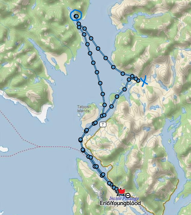
Here is a little map snippet that shows my route from Bar Harbor to the USFS dock at the Naha.

It's about 21 nm one way to get out there. Sometimes I drop shrimp and/or crab pots on the way out, but I did not do that on this trip. Setting pots is pretty easy when I am alone on board but pulling them is another matter. When I am pulling pots, I have to be on the back deck working the hauler. And when I am back there, I cannot control the motion of the boat. Even in calm weather the boat is always moving. If the boat swings over the pot line and it gets tangled in the props, then I've got a serious problem. I have done it alone many times, but I certainly prefer to have help when pulling pots.
So, I made my way directly to the USFS dock at the Naha, a place I have gone many, many times.
When I got there, I was not at all surprised to see that no one else was there. Not many recreational boaters go out in the winter.
I got tied up and secured the boat and then just took a few photos right there around the dock area.
The weather was sunny and clear, and cold, but not dangerously cold.
Here are a couple of obligatory shots of Faraway at the dock.


I almost always tie up on the port side of the boat, but this time I moved my bumpers and lines and tied up with the starboard side to the dock. I did that because I wanted to be able to get on and off the boat using the transom door and the swim step and the transom door is on the starboard side. As it turned out I didn't end up using the transom door because the dock was so icy and slippery that it was safer to step out over the gunwale using the step. One of my boating buddies some years ago slipped on the dock while getting out of his boat and actually broke his arm, and I sure didn't want that to happen to me.
Here's a shot looking out from the dock towards Naha Bay. Sometimes in the evenings we get some nice sunsets looking out that way.

I had a good lunch on board and then got my cold weather hiking gear on and took a walk up the trail. Actually, I went up the trail twice, taking a shorter hike on Friday afternoon and then a much longer hike on Saturday morning. But I will merge all the photos together for the purposes of this blog since no one cares which day they were taken.
Here are a couple of shots of the picnic shelter. We have had so many family picnics here over the years, it is a place of many happy family memories. It is somewhat melancholy to be here all alone, but I still enjoy coming here.


There is what I call a "skid way," (my term) alongside the rapids that connect the salt water with Roosevelt Lagoon. It was originally designed so that people could put a small skiff, a canoe, or a raft in at the saltwater side, and then drag it along the "skid way" and dump it into the lagoon. It has deteriorated badly over the decades, and is not functional now, but remnants of it remain.


Here's a short video of the rapids that lie between the saltwater and Roosevelt Lagoon. At high slack tide you can run a jet boat or a small skiff through the rapids. At any other stage of the tide, they are pretty much non-navigable.
Many people have brought small watercraft up from the saltwater and stashed them at the base of Roosevelt Lagoon. Their intent was most likely to cross the lagoon and access the Naha River, which is up at the other end of the lagoon. But what usually happens is that they just abandon them there and they slowly but surely deteriorate. Some are in better shape than others.


The trail meanders through the woods for a long way, but most of the time you can see Roosevelt Lagoon from the trail. I will be showing numerous photos of the lagoon from different places along the trail. It was such a stunning weather day that I could not resist shooting photo after photo of the lagoon.


I saw a lot of what we call "Bear Bread" on the trees and stumps along the trail. This is not a scientific name, but a colloquial name. Sometime I must ask Google or ChatGPT what the actual scientific name for Bear Bread is.


I mentioned bad weather earlier in this post. We've had some torrential rains, and when that happens the water level in the river and in the lagoon rises dramatically. There was a lot of evidence of high water along the trail.
In this first photo you can see a lot of debris from the lagoon completely covering the trail.

Here are several shots of Roosevelt Lagoon from different spots along the trail.


If there are any geologists out there perhaps they can tell me what kind of rock this is.

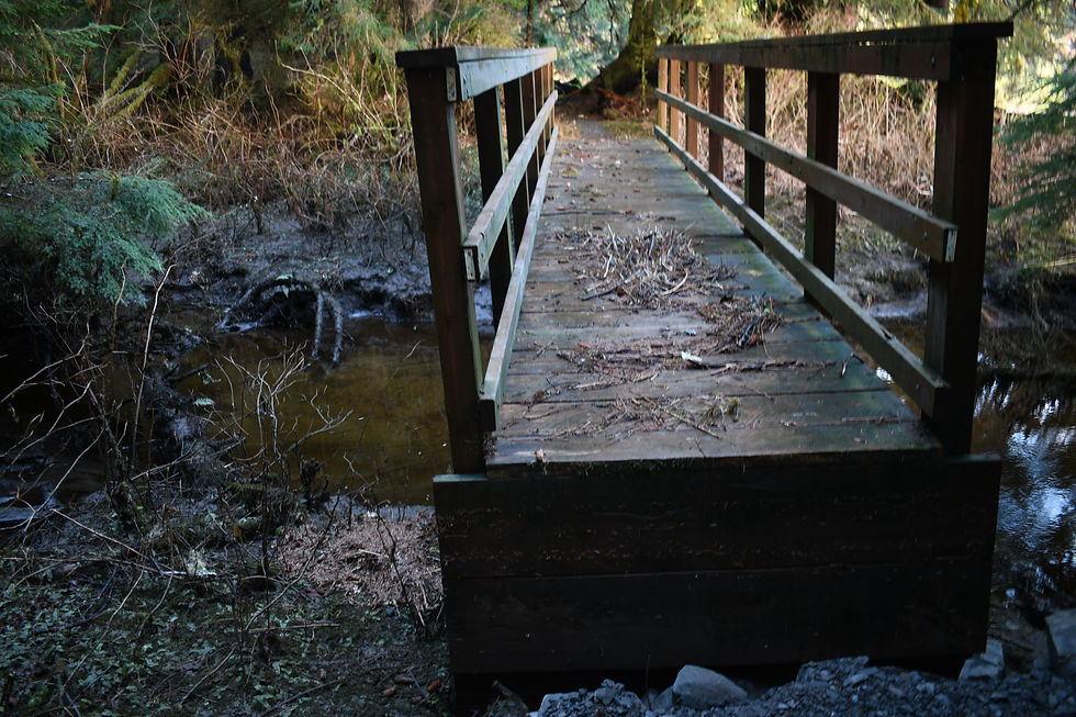
Here's another shot that shows how high the water level was at some point. This bridge is at least 5' or so above the little creek that runs below it. But there is debris from the water on top of the bridge, which means at some point the water flowed over the top of the bridge! I'm glad I wasn't here for that.
Here are a few more shots of the lagoon from farther up the trail.


I came across this small foot bridge that was completely out of alignment. The water had come up and literally floated it out of position.


The USFS worked very hard on this trail last summer and did an amazingly good job on it. But, over this fall and winter we've had many big storms so there are new blow downs and obstructions along the trail now. I have a contact in the local USFS office in town, so I took a lot of photos of the new obstructions and sent them on to her. These 2 shots are just one example of one of those obstructions.


Hopefully at some point before the summer season the USFS will send a crew out with chain saws and clear these areas.
That's about it for my photos on this trip.
The only other issue of note is that when I attempted to start my engines to head back to town my port engine would not start. I suspected low battery, so I started my generator and charged batteries for about 15 minutes, and then the engines started properly. But I did notice that the voltage meter on one side of the panel was extremely low. My batteries are 10 years old now so unfortunately, I think it is time to start a project to replace them.
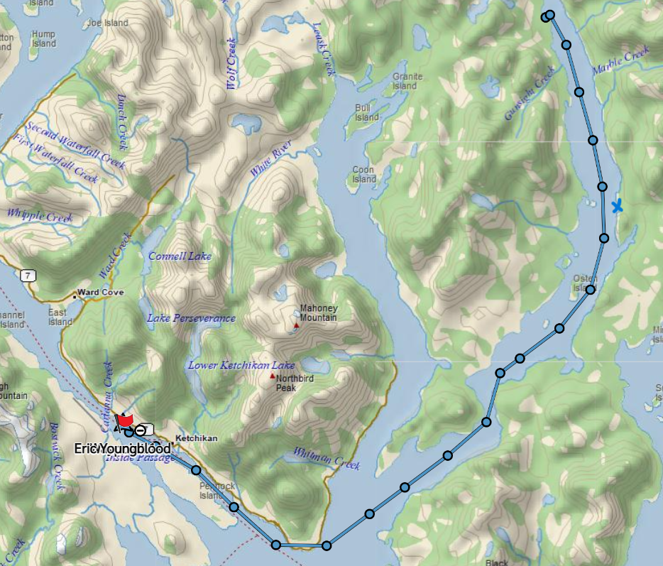
The run back to town was uneventful, but I did have to zig zag a bit in order to avoid looking directly into that blazing sun. I've learned from experience that running directly into the sun when you can't see the surface of the water is just like running at night. The risk of hitting something drifting in the water is high. But if you make like a sailboat and tack, zig zag back and forth, you can make forward progress.
I made it back to town just before dark and logged a little over 41 nm for this trip.

Comments